The trip was organised by Mark Lafontaine, who has written his own account of the trip on his blog at http://wildpaddler.blogspot.com. We planned for a 4 day trip, with a total distance to cover of 40 km, starting and finishing in the community of Stanley Mission. Our goal for the first day was the shores of Iskwatikan Lake and a distance of about 12 km. That would leave us an 8 km trek to the falls on the second day, for a 16 km round trip with a light load. The third day was planned as a day of local exploration, relaxation, rest and recovery. On our fourth day we would head back home again via the same route.The forecast for the trip was for nothing but mild weather with lows in the -15 range and highs that had me concerned about getting wet from melting snow (not a good thing when winter camping). Well, that's what was expected anyway...
An embedded map showing the community of Stanley Mission, approximately 500 km North of Saskatoon:
View Larger Map
Stanley Mission is a Cree community of about 1,400 people on the shores of Mountain Lake, part of the Churchill River. From Stanley, the Churchill flows eastward through Stanley Rapids into Drope Lake and Nistowiak Lake beyond. Stanley Mission is a common start point for canoeing and fishing adventures, a common trip being to paddle downstream to Nistowiak Lake in order to view Nistowiak Falls. The falls themselves are not part of the Churchill River, but rather the Rapid River. However, they are located just a couple hundred metres from where the Rapid River joins the Churchill River at Nistowiak Lake.
(Click image for a full-sized version)
Our group stayed in a motel in La Ronge on Friday night so as to be ready to start our journey early on Saturday morning. Our first sign that the forecasters had got it wrong was the groan with which our vehicles reluctantly started outside the motel in the pre-dawn of Saturday morning. After a few delays and with our vehicles safely parked at the RCMP depot, we started out form the easternmost point of Stanley, a peninsula that juts out into the Churchill River. The temperature when we started out was cold, about -25C, and despite the sunshine a fog hung in the air from the nearby open water of the river. The fog made for a really great visual effect, forming an undulating layer about 20 to 30 feet above the ground and only about 10 to 20 feet thick. My camera batteries were too cold for the camera to work (having spent the night in the car) so some of these initial photos are courtesy of Zoe & Mark.
From the road, looking toward the peninsula where we unloaded the vehicles and started off.
Mark, Zoe, Bryan (me!) Laurie, Bob & Mike ready to go. Mark & Zoe's photo.
Fog in front of the church at Stanley Mission. Mark & Zoe's photo.
Me, setting out with my loaded toboggan. Mark & Zoe's photo.
Following the skidoo trail away from Stanley and under ribbons of fog. Mark & Zoe's photo.
This trip was my first one using my new UHMW (ultra high molecular weight polyethylene) plastic toboggan. Made from a 1/4" thick, 10' by 16" piece of plastic, there is a little about 9' of loadable space behind the front curl. Unlike the pulks of the others which are being towed by ropes through metal or plastic conduit as poles and connected to a harness, I used rope. I connected the rope via small carabiners to a beefy fanny pack that doubles as harness, or to a 36"' length of 2" webbing (a tump). The webbing strap could be positioned in any of a variety of ways, including across my chest or over one shoulder and down to my side and is a more traditional way to pull this high tech old-fashioned toboggan. When using the fanny pack, I had my hands free to use ski poles to help myself push up the hills. However, when going up one steep section, the buckle of the pack came apart and the 140 pound sled slid backwards down the hill, nearly taking out Bob in the process.
The first leg of our route out of (and into) Stanley Mission as recorded by GPS, click for a larger image. The purple line is actually from our way out, with the white lines being what was recorded on the way in. I was using regular and weak AA batteries initially and the GPS did not start working consistently until those were swapped for fresh lithium batteries.
Our path followed a skidoo trail away from the Churchill River overland for 10 km to Iskwatikan Lake, crossing a handful of small lakes (the largest being Bow Lake), sloughs and beaver ponds along the way. The path was usually fairly narrow, about one snowmobile wide, and was well travelled. Occasionally we were overtaken or met a snowmobile on the trail which required that we make haste and get off the trail in a hurry. My toboggan was sometimes difficult to get off of the trail quickly and required a certain amount of clear space in the bush into which I could head into. However, off trail, the sled handled and negotiated surprisingly well through the underbrush and between the trees.
The hills on our route were generally short and steep, with the trail undulating over ridges. However, there were a few brutal long, though not overly steep, sections to climb. It was going up those hills that I really noticed the weight on my sled (later weighed and approximated to be 140 pounds, about 60 pounds higher than anyone else!). This being my first time using the new toboggan, it took me some time to really learn to drive it. There are some skills involved, especially for managing the downhills. When towing with my arms wrapped behind me in the ropes, I found that they work as a sort of shock absorber allowing me to take up some of the slack when the sled was catching up to me, and to absorb the shock when the sled slowed. Also, when the toboggan ran downhill, it would run over it's ropes which would then act as a brake and usually keep the sled from catching up to me. For other downhills I found that by holding the tow ropes and the stern rope at the same time, I could walk the sled downhill, much like lining a canoe down a rapid. I was also able to walk the sled downhill from behind while holding onto the towing ropes (which is why I had made the ropes over 10 feet long so that they would reach all the way from the bow to behind the sled).
Walking the sled downhill ahead of me.
Another look at the toboggan. There is a short rope on the front allowing something to grab other than the long towing ropes when desired. There are also a pair of eye bolts attached to u-bolts that go through the tow bar. The eye bolts are attachment points for rigid poles similar to that used on my pulks, as system I wanted to try out but I forgot the poles at home. The eye bolts are fitted into a short piece of garden hose to keep them from dangling down.
A short video of me learning what happens on the short steep hills when the sled abruptly stops, but I don't.
Second leg of our route into Iskwatikan Lake and our campsite (click for a larger version). There were was a high ridge to cross to reach the lake.
Elevation profile of the route as generated by MapSource v. 6.15.
Elevation profile recorded by the GPS. This is after some of the most obviously out of whack points have been cleaned up, but a couple remain.
Bryan, Mark, Bob, Zoe, Mike & Laurie enjoying the sunshine after arriving on Iskwatikan Lake. This photo was taken for us by a Stanley Mission family that also stopped for a rest en route by skidoo to their cabin, another 58km farther. Mark & Zoe's photo.
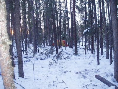
After travelling along the shore of Iskwatikan Lake for about two kilometers we found a place along shore that looked promising for a camp. The spot we eventually settled on was back a bit from the shore, tucked into the black spruce in a spot that would have been horribly buggy and damp in the summer. However, in the winter it serves just fine.
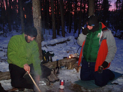
Our evening around the fire was a tad cool as the temperatures never did get very warm that day (in contrast with the forecast) and the evening temperatures were around -25C. It was off to bed relatively early since it would be another early morning the next day. Mike & I retired to the hot tent and got the stove going again (we had it running earlier in the evening for a while after camp was set up) while we prepared for bed.
Mark's thermometer at some point in the first evening. Mark & Zoe's photo.
My sleeping system included a thermarest pad with a shorter foam pad underneath (and a layer of spruce boughs), a -12C MEC bag, a MEC overbag, and a vapour barrier liner. The latter was being used for the first time. I've brought it along a number of times but never felt it was cold enough to warrant it's use. I've also been somewhat put off by the thought of sleeping inside a non-breathable plastic bag which surely must feel damp and clammy. I wore Stanfield superwash wool long undies, thin merino wool liner socks, and a toque to bed and not only was it not clammy and damp, but I was comfortably warm all night. Except my face; that did get cold and I rectified it sometime in the night or early morning by pulling on a fleece hood & face covering.
We awoke to -30C temperatures so I quickly (no, make that 'reluctantly') set about getting the fire ready. Unfortunately, we didn't have a lot of firewood and kindling ready to go, so I found myself scrambling for wood and snapping branches into shorter pieces of kindling, and gathering my fire lighting supplies. I then learned that my lighter would not work at -30, it was too cold. Switching to matches, I could not find anywhere to strike my "strike anywhere" matches. The stove was too new to have any rust or rough spots, and we were sleeping on a bed of moss and snow covered in pine boughs, not a rock anywhere. Of course, striking one match against the other always works, but by now I had lost all dexterity in my cold hands and I could not manage to get better than sparks before wrecking the heads. With thoughts of the Jack London "To Build a Fire" story in mind, I switched back to the lighter which I had been sitting on in the meantime in order to warm it. Thankfully, this time it worked and I was able to get the stove lit, but not before becoming quite chilled. I returned to the sleeping bag while I waited for the tent to warm with the fire and while listening to Mark getting the main campfire going outside.
Breakfast by the campfire. Mark & Zoe's photos.
Our plan was for a quick breakfast before hitting the trail, but camp duties take longer in the cold and some got quite cold in the early morning hours. Also, some had a cold night with sleeping systems that were insufficient at minus 30. Eventually we did get underway and those that were chilled could begin warming themselves through activity.
Sunrise near camp. Mark & Zoe's photo.
The falls were 8 km away from our camp and we followed the skidoo trails on Nistowiak Lake. At one point there are a couple of islands that one must go between so we exercised a fair degree of caution in that area. Although we were on a lake, it is part of the Rapid River there is potential for current around points and between islands. We spread our group out so that no more than one person could run into trouble at once. We also carried ropes or throw bags to assist in a rescue form the water if need be. Thirdly, we stuck to the snowmobile trails where others had passed safely before us. The snowmobiles pack the snow and decrease it's insulative value allowing the ice to freeze more thickly.
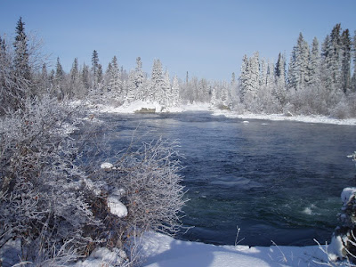
Once in the vicinity of the falls, we followed the trail inland. This trail starts well above where the river exits the lake, unlike the usual canoe portage. We toured down to the first rapid that marks where Iskwatikan Lake spills into the Rapid River, then continued on to the top of the main waterfall. There, we found ourselves in awe. The waterfall plummets 10m and in doing so throws up a large amount of spray. In the winter cold that spray freezes to everything it touches and as a result the scenery of the waterfall is an ice-covered wonder. The sheer quantities of ice that entombed the trees was incredible. The colours of the ice, and the rainbows in the bright winter sun were visually impressive. At the moment that each person reached the top of the falls they knew the cold and long trek was worth it. A written description and even photos won't really do it justice, you are just going to have to take a trip there for yourself.
Mike looking out toward Iskwatikan Lake from the top of the first rapid.
The first rapid exiting Nistowiak Lake, about 300 m above Nistowiak Falls.
The pool below the first drop and above Nistowiak Falls.
Zoe enjoying the scenery of the first rapid.
Mark heading back out on the trail toward Nistowiak Falls.
En route to the falls.
Looking back toward the first rapid while en route to the falls.
There was some confusion over which way to go (which led to our side trip to the top rapids). But, being skilled and experienced woodsmen, we were able to read the signs of nature to find our way.
Mark, Zoe, Mike & Laurie take in the scenery at the falls.
Some of the huge masses of ice formed by the spray being thrown up onto the trees and rocks.
The first drop of the falls.
Rainbows in the sunshine.
Mike absorbing the spectacle.
Mark heads down toward another vantage point.
Lunch above the falls.
We spent about an hour at the waterfall, taking in the scenery, basking in the sunshine, and eating a frozen lunch. We did not explore down to the bottom of the falls, or Fissher Rapids below, and being concerned about getting back to camp with a wide margin of remaining daylight, we got back on the trail across Iskwatikan Lake. The temperatures for the return trip had warmed up to about -15C and we had a slight tail wind, very nice travelling conditions. We were heading into the declining sun and I was glad to have my goggles with me. In fact, several folks developed a good sun tan on the trip and my wife commented later that I had a lot more freckles. Sunblock would have been warranted given the amount of light that was being reflected off of the white world around us.
Brilliant sunshine and sundogs.
Bob and Mark lead the way.
Some of the Iskwatikan Lake geography.
Mike and Laurie. Laurie must be finally warm - no toque or mitts!
Heading toward a narrows between the islands.
The group spreading out for safer ice travel.
Mark & Zoe and a valentine's message.
Wolf tracks near camp. Mark & Zoe's photo.
Mark & Zoe's photo.
Back at camp on our second evening we endeavoured to put up a lot more wood in order to be better prepared for both evening fires and for the coming morning. Zoe sawed and sawed and sawed. The rest of us collected, dragged and split, spelling Zoe off the saw for short stints. Mike & I also collected a bunch more spruce boughs in order to improve our bedding in the tent. We enjoyed a beautiful evening in camp with a gorgeous sunset and I think the temperatures actually continued to rise a bit. Mark noted that he thought the weather had turned (for the better) and he would later be proven correct.
Mark & Zoe's tent.
Setting sunlight on the trees.
Sunset over the water hole. Mark & Zoe's photo.
Bob by the campfire with a gorgeous sky beyond.
Laurie dressed to stay warm while relaxing by the fire.
Mark & Bob tend to their suppers while discussing the best methods for thawing frozen wine and why glass bottles of wine are not ideal.
Valentine's evening at camp.
After supper by the fire, we retired to an evening in the hot tent with the stove burning, something we should perhaps have done the previous evening when the temperatures were much lower. The tent easily accommodates 6 relaxing folks.
Because of the cold earlier in the trip we had decided to pack up and head out on our third day, originally planned as a day to relax or explore near camp. That was decision was made in the cold of the second day, and I think some were relieved. There was concern it seems over how some would keep warm during the relative inactivity of our rest day. So, it was another early morning the next day in order to break camp and get started on the long haul out. Our second morning broke much warmer than the previous one and life in camp was pretty comfortable. After packing everything up and loading the sleds, we struck out on our return to Stanley Mission.
Making a few adjustments before leaving Nistowiak Lake and entering the overland skidoo trail to Stanley.
The return trip was nearly as hard as the trek in, but the weather was sunny, calm and pleasant. The temperatures were certainly climbing. We were in a bit of a hurry to ensure we made it back at a reasonable hour in order to pick up our vehicles from the police station. Once we got out in the open near the town of Stanley Mission we became aware of a stiff breeze blowing.
Some of the exposed shield capped in snow.
A look at the trail.
A lunch break of tea and gorp in a sunny spot en route.
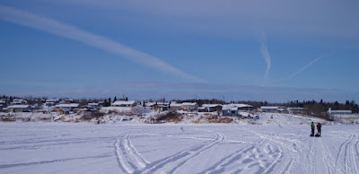
Emerging from the trail into a bay near Stanley Mission.
Our trail passed a bit less than 1km south of the Holy Trinity Anglican Church.
Open water of the Churchill River near Stanley Mission. Amachęwęsp
After retrieving our vehicles from the police station and loading everything in, we began the long drive home. The drive was uneventful, except that Mike was feeling the full effect of flu-like symptoms he began to feel on the trail. Thankfully, there were no unexpected stops on the side of the road to account for this. I did make one extra stop in an effort to help some folks change their tire on their half-ton. It was one with the spare stored underneath the vehicle and released by inserting a crank and turning to lower the cable. Unfortunately, something was stuck or broken because nothing I could do helped. It was about then that the lady mentioned none of the previous 6 guys that stopped had any luck either. Thankfully, a tow truck from La Ronge arrived about the time I was leaving.
Back at home, I was generally tired as hell for the next few days, literally wiped out. My muscles were sore, but not overly so, and time in Mike's sauna may have helped alleviated some of the aches in that regard.
All in all, it was a great trip. I learned that some of my untested stuff worked very well at minus thirty, and I learned that I could withstand an arduous but adventurous trip. I still think it would have been better with the extra day in there to rest up a bit and enjoy life around camp before heading out, but I know better now what my limits might be. I have a long list of things learned from this trip, something the group all shared with each other by e-mail after the trip. I'll re-format and paste the list in as a post of it's own.
Our complete route in and out from Nistowiak Lake. Click on the image to view full size.
For a list of Lessons Learned, see the post at http://pawistik.blogspot.com/2010/03/lessons-learned-nistowiak-falls-trip.html.


Không có nhận xét nào:
Đăng nhận xét